USGS Wildfire Studio
- Public Policy
Fall 2010
In an ongoing partnership with USGS, this Graphic Design studio was asked to design a visual identity and branding strategy for the Wildfire Scenario, a set of scientific data foretelling the natural disaster that is both devastating and a reality of life in Southern California.
“The USGS Wildfires studio has been yet another wonderful partnership between the USGS and Art Center. The results the students created are so innovative and exciting, and they help move us closer to our ultimate goal: bringing hazard science to the communities of Southern California.”
— John Bwarie, USGS
“Having the fresh perspective of our students is such a valuable asset to an organization like the USGS. These students represent the very group that USGS is trying to reach.”
— Gloria Kondrup, Graphic Design Faculty
“Because I grew up in the wildland-urban interface of San Diego County, wildfires were an important subject to me. Getting to work with the USGS and utilizing technology to drive adaptive design was an experience I greatly enjoyed and grew from as a designer.”
—Tyler Paulson, Graphic Design Student
Design Brief / Challenge:
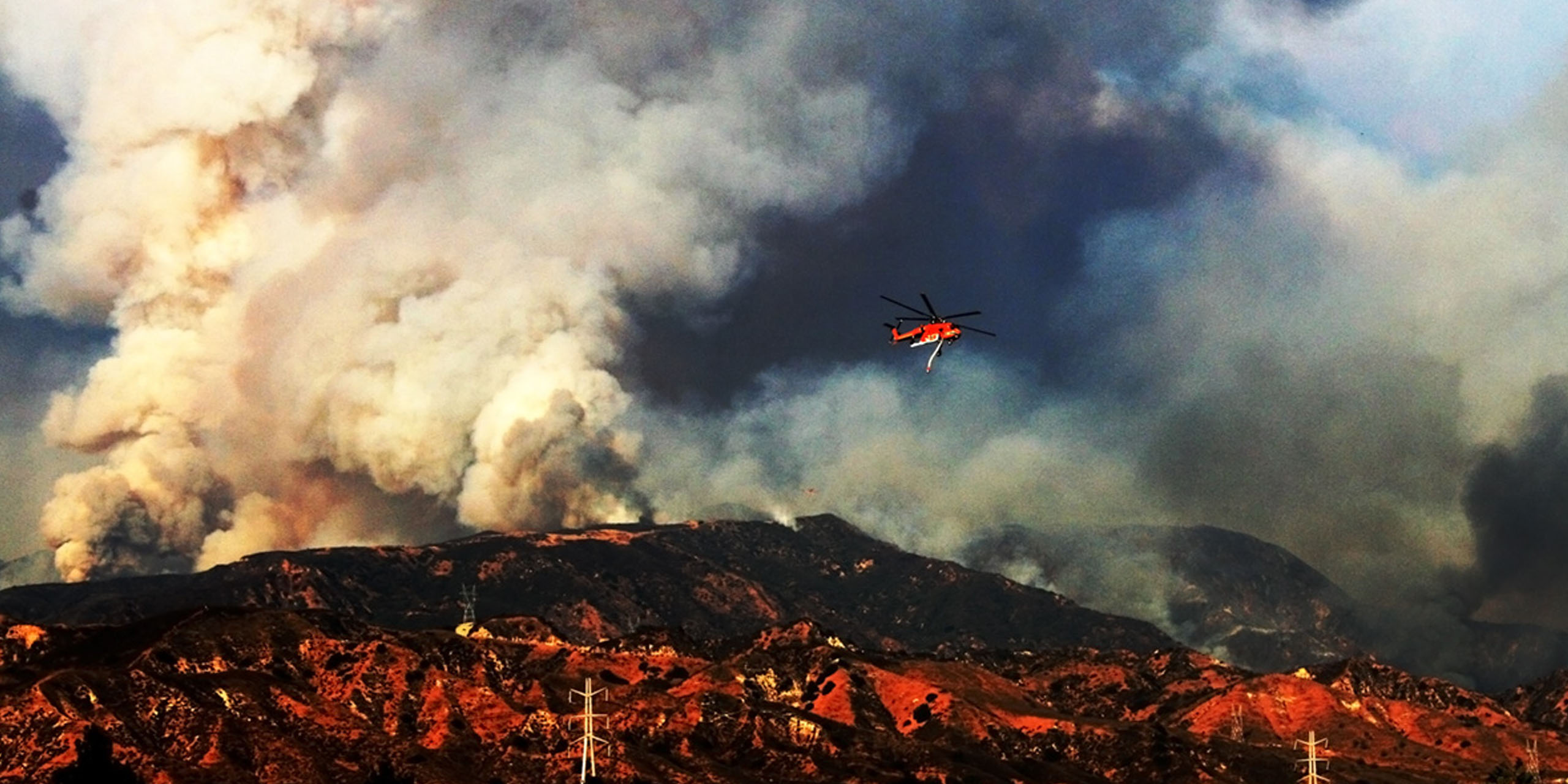
On the edges of our cities and towns, there is a living, dynamic relationship between our man-made environments and the omnipresent forces of nature. A peaceful, symbiotic existence exists when this relationship is thoughtfully and carefully nurtured—yet a potentially destructive, and even violent, environment can quickly emerge if not.
Understanding how to successfully manage these shared boundaries between mankind and nature is crucial to preventing full-scale fire emergencies. Maintaining a peaceful relationship between urban development and the unique natural environments so treasured as part of the Southern California landscape is a necessity.
For this studio, the U.S. Geological Survey charged students with establishing an identity system for their Wildfire Scenario, a compendium of scientific knowledge to address wildfire prevention and education through research and governmental advocacy.
About the U.S. Geological Survey (USGS):
A bureau of the United States Department of the Interior, the USGS is a governmental scientific agency that provides impartial information on the country’s landscape, its natural resources, and the natural hazards that threaten it.
Multi-Hazard Demonstration Project Mission:
The USGS Multi-Hazard Project is improving our resiliency to earthquakes, floods, wildfires, landslides, tsunamis, and coastal erosion in southern California by applying science to community decision-making and emergency response.
Research and Project Development:
Before they could begin developing solutions, students had to research the work of the USGS and, specifically, the Multi-Hazard Demonstration Project–its mission and the issues it faces. Through extensive research and interviews with USGS researchers and scientists, they began to comprehend the multi-tiered approach a campaign to address wildfire prevention in Southern California would need to have.
The students continued by doing field research—visiting and documenting the very areas most impacted by wildfires. Students documented and researched native chaparral and drought-resistant areas to better understand why these areas have an exponentially higher risk of wildfire hazards than neighboring areas.
Outcomes / Projects:
Each student developed a solution for the USGS that included a unique identity system and marketing strategy. Students recognized that individuals use very different ways to digest information—from reading books to visiting websites to downloading mobile applications—and designed their campaigns to reflect this. All campaigns mindfully utilize real-time scientific data, in order to provide audiences with the most up-to-date information on their specific area. This “as-it-happens” approach proves crucial on a day-to-day basis as well as during a wildfire hazard.
Outcomes
 close
close
THE WUIS
Read moreXian Shane
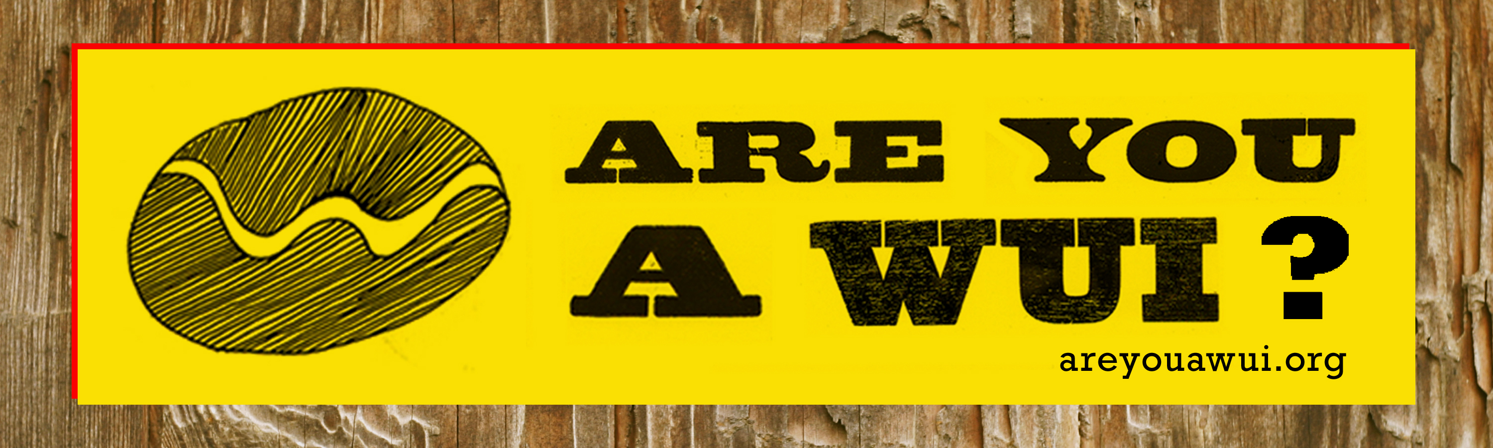
A WUI is a frequently used term for those in fire science and management, and stands for the “Wildlife/Urban Interface,” or the borders where urban environments and the wild landscape mingle. This campaign puts forth the concept of a person as a “WUI” or an individual living in a community that is situated on the edge of wildlife—in other words, an area that is at high risk of wildfires. The WUI campaign is designed specifically for these communities, and envisioned as a grassroots effort to foster community pride in WUI residents and build collaboration around mitigating wildfire devastation in these most-vulnerable communities. Materials created include a brochure, newsletter and an “Are You A Wui?” bumper sticker. An interactive mobile application provides wildfire tips, reminders, contacts and news. This makes for a very personalized experience, which can be modified for individual neighborhoods. In the summer and fall of 2011, USGS commissioned graphic design alumna Xian Shane to further develop her “Are you a Wui” campaign. The Designmatters and USGS teams, with faculty mentorship from Gloria Kondrup, worked closely with Xian to produce several updated additional outcomes of her original idea, including: WUI bumper stickers, buttons, a brochure and a website landing page for the campaign. Plans to implement these outcomes are underway with USGS over the next several months. To see the WUI website click here.
 close
close
FIRESAFE
Read moreRicky Valerio
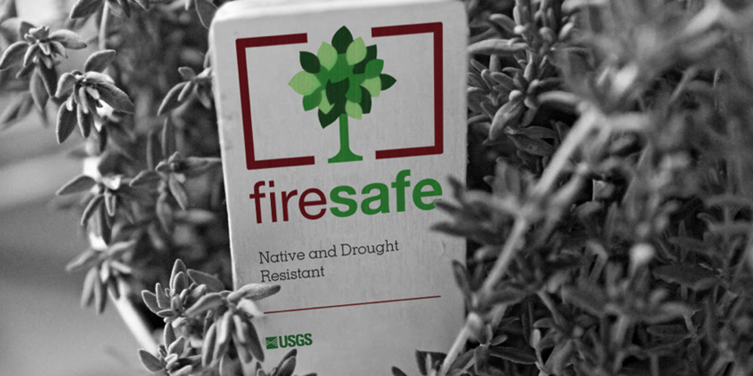
The Firesafe identity imagines a partnership between the USGS and Southern California gardening stores. Because planting the wrong types of plants in a wildfire-prone area can make a wildfire more volatile and spreading, this system influences home gardeners at the point of purchase, educating them on fire-resistant landscape options. A brand logo and retail tags were designed for plants, with different color palates representing varying plant profiles—for instance, one plant might be fire resistant, another drought resistant and yet another a native plant. Some are a combination of all three. The value of these tags in garden centers is that they can raise awareness of wildfire prevention, reminding consumers that wildfires are an issue in all of Southern California that they can help mitigate. In addition to plant markers inserted inside their pots, a mobile application was created advising which plants will work best for a particular area code.
 close
close
FUSE
Read moreBianca Fuchs
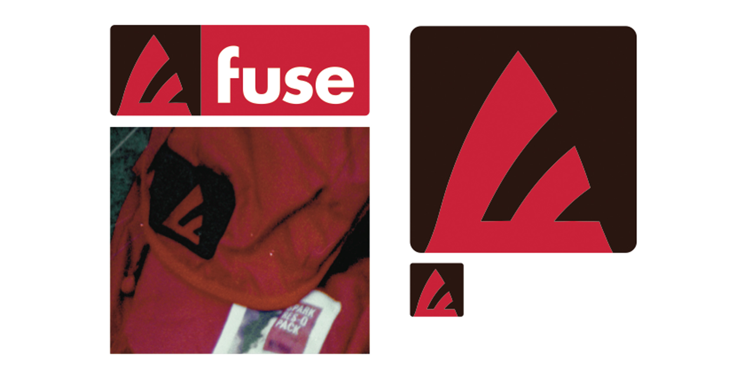
The FUSE identity partners the USGS with an outdoor clothing company to produce fire-safe attire in order to promote awareness and generate funding for the cause. FUSE stands for “Fire Understanding Saves Ecosystems.” The campaign could form partnerships with sportswear retailers to create and brand fire-resistant clothing made of such materials as nomex and templar. A heavy emphasis was placed on saving both people and the environment from wildfires; and also on making quality, durable and desirable clothing that can be worn in times of a wildfire hazard. Clothing tags display what traits a particular product features (such as being heat or fire resistant) and heavy emphasis is placed on producing functional clothing and accessories that are durable and stylish. In addition to a book and a website around the identity, a series of posters and bus shelter graphics were also designed.
 close
close
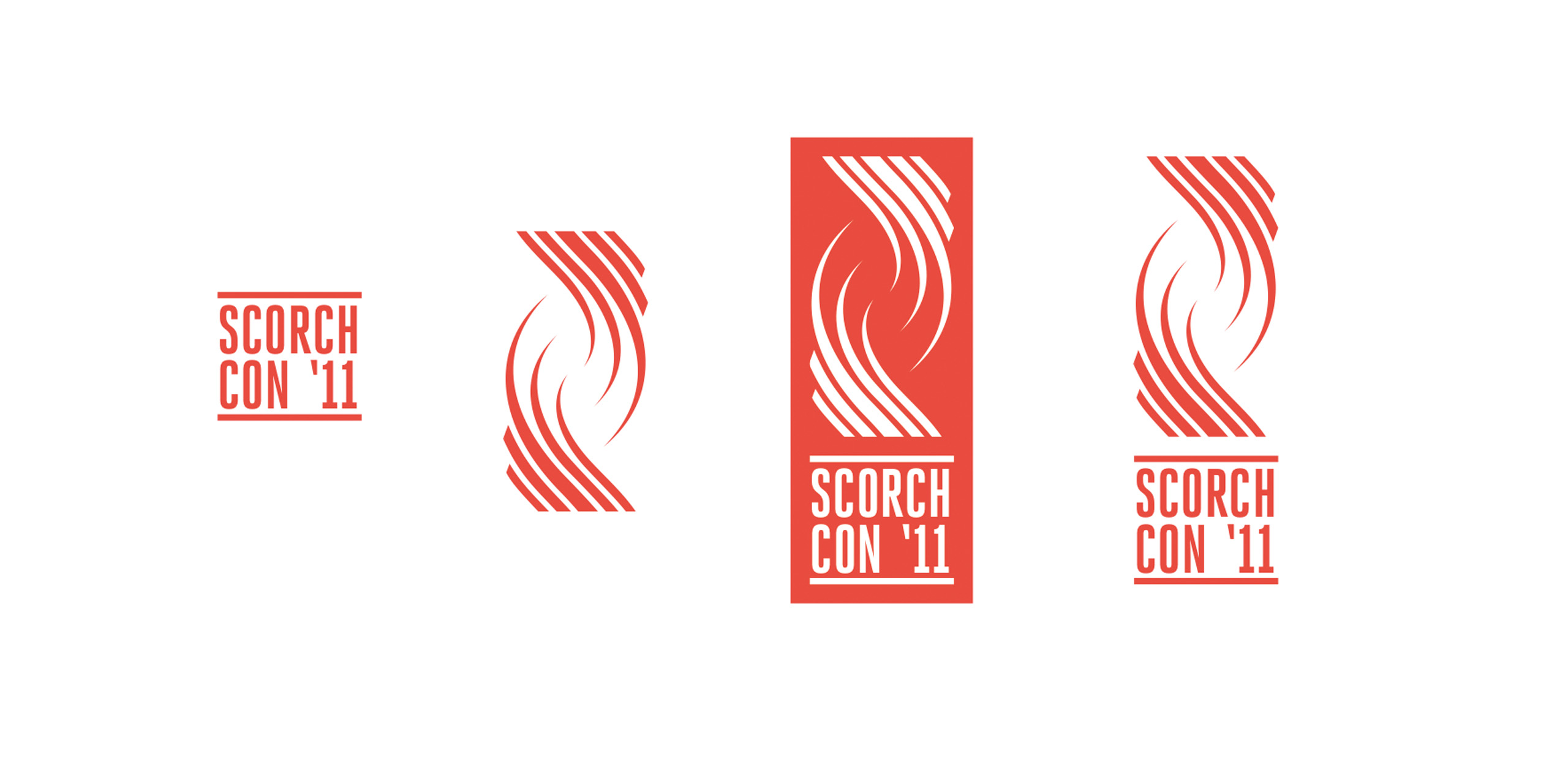
SCORCH
Read moreEd Schofield
SCORCH (Southern California Organization for the Research of Chaparral Hazards) is an institution identity aimed at coordinating the many agencies that partner to combat wildfires. With an “S” standing for SCORCH, the logo was designed in a way to represent both fire flames (in particular the Crown Fire which occurred last summer) and the grasslands present in the ecosystem. Brochures, outdoor banners, letterhead and a website were also created, with an emphasis on keeping the campaign scalable and cost-efficient.
 close
close
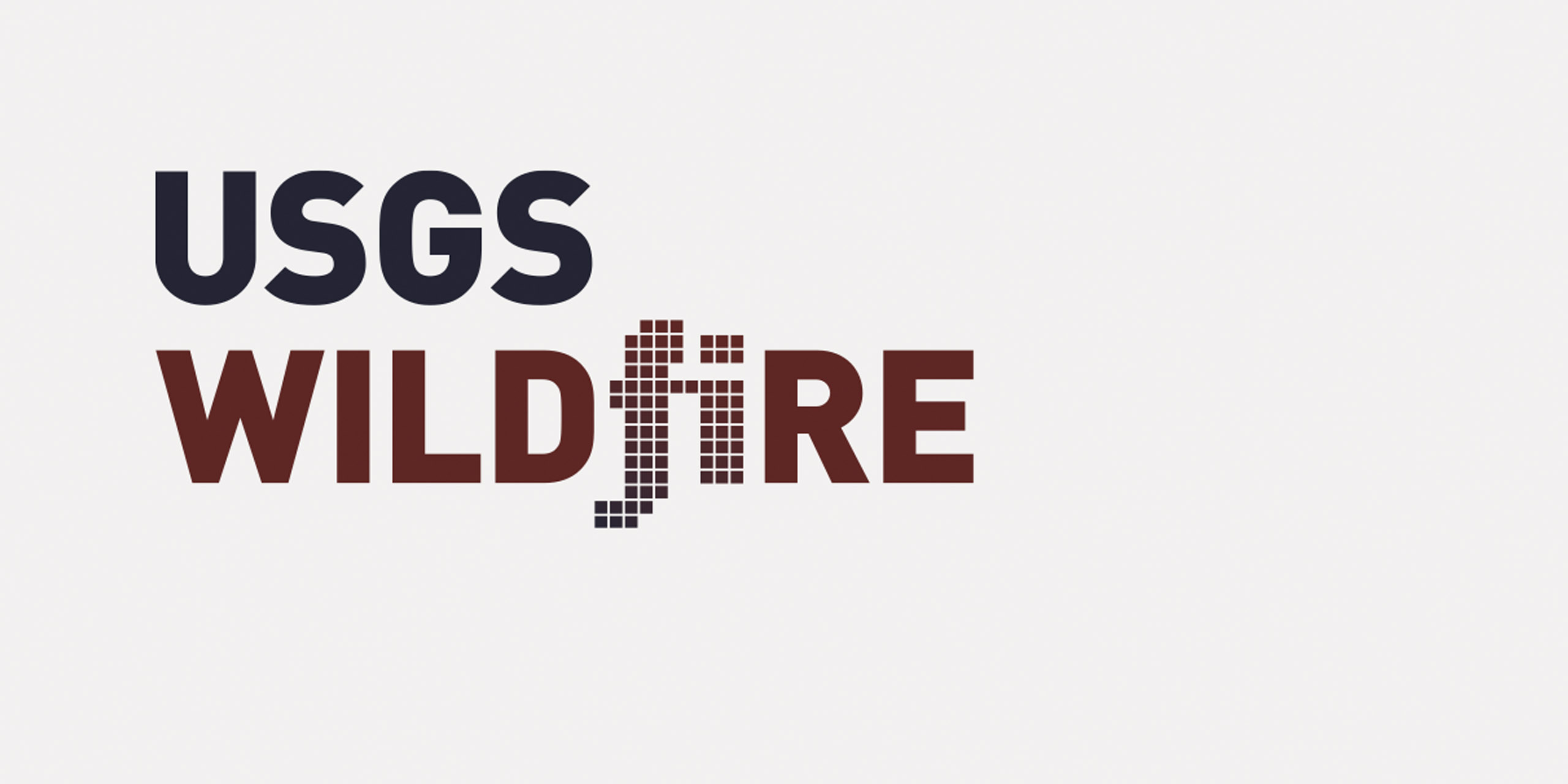
WILDFIRE
Read moreTyler Paulson
The Wildfire identity was designed for the digital world, engaging the public through digital spaces. Its primary goal is to educate users in situations where a growing wildfire hazard may be emerging. The Wildfire application is based on a modular logo that was created to dynamically change (in size and color palette), in response to real-time wildfire hazard data. This technological and adaptable campaign seeks to push USGS to the public education forefront, as the primary authority on wildfires. In addition to a mobile application, a desktop PC application and a public service announcement were also created, showcasing various elements of the campaign and its function.
 close
close
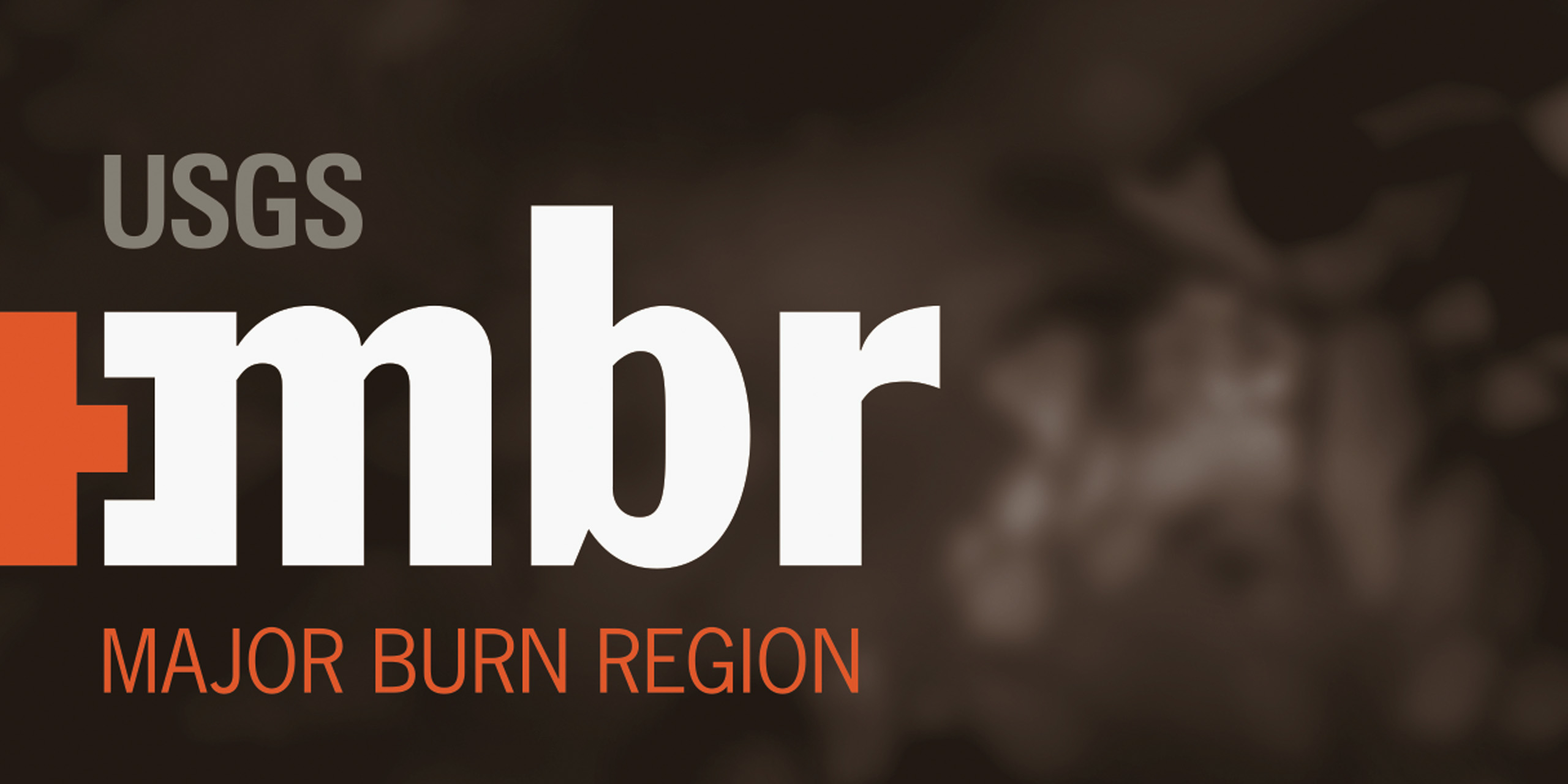
MBR — MAJOR BURN REGION
Read moreJim Bogenrief
This campaign focused on developing regional governmental groups within an over-arching identity. A strategy for conventions and inter-agency communications was also created. MBR (“ember”) is tailored to be region-specific, providing people of a particular area with wildfire hazard news relevant to them. The identity and brand was designed with this in mind, taking care to present the program as knowledgeable and trustworthy. Mobile applications geared around GPS were created, showing live satellite imagery, illustrated maps, videos and live Twitter feeds specifically tailored to the location where the application was being used. A website was created supporting region-specific branding. Ways in which a branding campaign could be implemented in an office environment were also explored.
 close
close
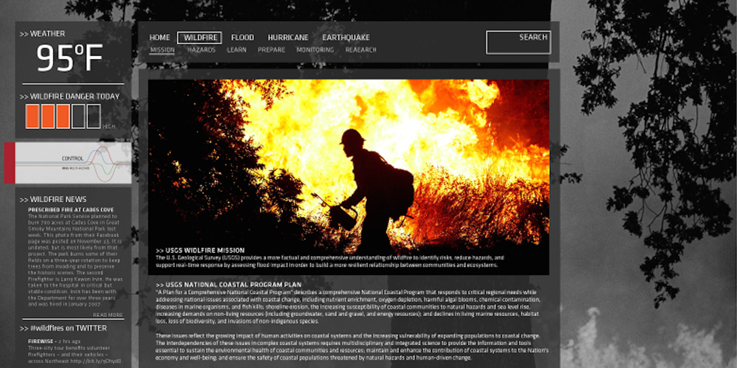
CONTROL
Read moreJinsub Shin
The Control identity sought to develop the wildfire scenario within the context of larger multi-hazards, developing multiple ways of communicating disaster information digitally. Using primary colors, each representing a specific hazard—wildfire, floods, earthquakes, hurricanes—the campaign aimed to be simple yet informative. The website and materials produced took into account the entire series of multi-hazard scenarios, how these natural disasters are interrelated, and how to mitigate them.